Technology is a great ally against floods

Most accounts agree that waves Tsunami Happened next Earthquake In Japan on March 11, 2001, they traveled across the Pacific Ocean at speeds of more than 800 kilometers per hour, close to that of a passenger plane.
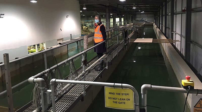
It may seem impossible to calculate the devastating impact of phenomenon Of this kind when it hits the ground, but in the UK there is a simulator to recreate it, with the main goal being to reduce future damage. Natural events.
It belongs to the research company HR WallingfordHeadquartered near town Oxford, in the UK. It consists of a canal 70 meters long and 4 meters wide, which uses 70,000 liters of water to recreate what happens in the tsunami disaster. The Environment Agency of that country is using the results of studies conducted into this massive infrastructure to identify flood prevention and mitigation measures.
Although it is a centuries-old problem in populated centers around the world, current climate conditions are of greater concern in this regard.
The United Nations warns of an increase in Floods In the five continents due to the warming of global warming, which by generating more evaporation from the oceans produces more rain.
There is no standard way to deal with these Natural hazardsBut there is no doubt that technology is becoming a great ally. Quito, for example, maintains a risk-prevention system that includes TV inspections to monitor a condition Complexes and sewage networks.
According to Metropolitan Public Watering Water and Sanitation Company data (epmaps), The information is transmitted by a robot that sends the signal from the inside to a vehicle equipped with audio and video. The operator can specify in detail whether there are cracks, leaks or obstructions.
They also have the Power BI platform, which is a historical view of accumulated precipitation within 24 hours. This makes it possible to determine the amount of water recorded in 35 weather and rain stations Installed in town.
It also operates the remote platform Paramho Which, among other functions, facilitates the visualization by graphing of the metropolitan climate conditions in real time.
All this is supplemented by the National Institute of Meteorology and Hydrology’s radar network (Inamhi), Which provides near-real-time data on the behavior of Quito’s atmosphere. Along with the satellite imagery, it is input from the capital’s Emergency Operations Center for its reports on rain alerts that could affect the city.
Low-cost systems make a big contribution
In the European Union Prevention and risk measures that include metal and glass bars on the banks of rivers crossing populated areas are being implemented, all according to the soil structure, with investments of millions of euros.
However, there is iniciativas ‘low cost’ (Low cost) gives good results. In Peru, since 2016, a prototype climate monitoring station has been used in a region Cosika. The containers are used to collect rain obtained from 3D printers, open source data collection software and solar panels to ensure power supply.
And in Nepal, A text message early warning system that promoted early evacuations that saved hundreds of lives during the monsoons in 2017 and 2018.

“Pop culture advocate. Troublemaker. Friendly student. Proud problem solver.”


:quality(70)/cloudfront-us-east-1.images.arcpublishing.com/metroworldnews/KAMPU362RJDWBEEJAHCQQIMWEE.jpg)


